Although New York established the town of Caroline in 1811, its boundaries did not take their current form until 1887.
The history of Caroline's European-style territory begins in 1606, with the grant by James I of England to the Plymouth Company of all the land in North America above the 40th parallel, from sea to shining sea. This kicked off a couple of centuries of wrangling between European great powers, American colonies, and representatives of the First Nations over legal title, a distinctly European idea, to specific areas of land.

The details of most of these disputes had little relevance to the history of the boundaries of Caroline, except for one. As the inheritor of some of the assets of the Plymouth Company, Massachusetts had a claim to large swaths of land in what is now New York. The Hartford Convention in 1786 awarded Massachusetts with 6,000,000 acres in New York. Much of this included land west of the Pre-emption Line, which is the west border of this map. (Click on any map to see a larger version.) Massachusetts also received 230,400 acres between the Owego and Chemung Rivers, which were named the Boston Ten Townships. In 1788 New York created the town of Chemung, which you can find in the south west part of the map. Legislation in the 1780s created the military townships, which created a more or less east-west line to the north of Caroline.

In 1791 a group from New York City, including John Watkins and Royal Flint purchased 363,000 acres of land between the pre-emption line to the west, the military tracts to the north, the Boston townships to the east, and Chemung to the south, as shown in the map above, for 3 shillings 4 pence per acre. This land was surveyed in 1794 and divided into townships. The late 18th century was a great era of land speculation in New York, as title disputes were being settled and vast areas became available for purchase from the state. These were the IPOs of the day. Fortunes were made and lost by speculators who were out to make a quick buck by subdividing and selling off, and had no interest in homesteading. As you can see from the previous map, the Watkins-Flint land was in Tioga County. (Previous to 1772, the Caroline area was in Albany County, then in Tyrone County until 1784, and in Montgomery County until 1791. Growing pains!)
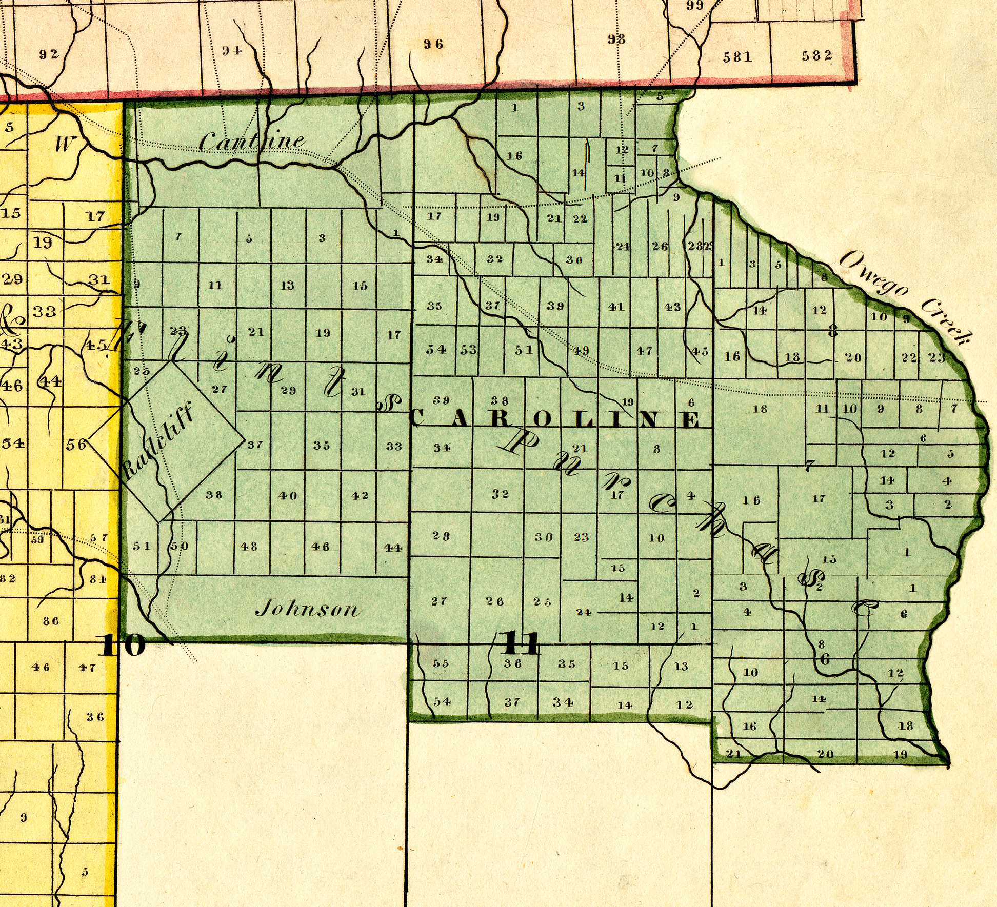
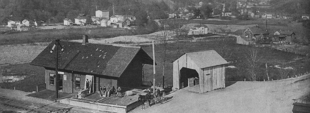
In 1811, the state passed An Act for dividing the Town of Spencer, in the County of Tioga, into five towns. The legislation describes the boundaries relative to preexisting lines that have mostly fallen out of use, but it becomes clear by referring to the above detail from the Burr map, the earliest map of the county. The description begins at the north west corner of the town. "And all that part of the town of Spencer, beginning at the military line, on the section line of township number ten ; thence southwardly on said section line to the southwest corner of the northeast section of said number ten; thence eastwardly parallel, with the south line of number ten, to the west line of township number eleven ; thence southwardly along the west line of said township number eleven, sixty chains; thence eastwardly parallel with the south line of township number eleven to the west line of section number six on Owego creek ; thence southwardly along the west line of section number six to the southwest corner of said section number six; thence eastwardly along the south line of said section number six, to Owego creek; thence up the Owego creek to the military line ; thence westwardly along the military line to the place of beginning, be a town by the name of Caroline ; and the first town meeting in said town shall be held at the house of Eschard Bush". An historic marker on Slaterville Road commemorates the last instruction, "1ST TOWN MEETING, Held Here In Bush Taven, Made Of Hewn Logs; April 1811 William Rounsvell, Supervisor Capt. Levi Slater, Town Clerk."
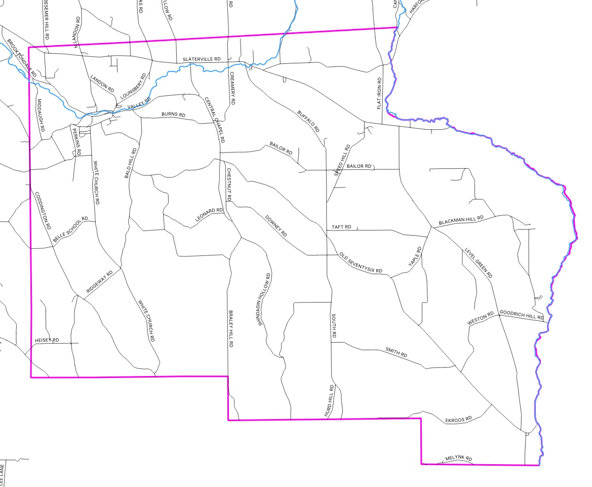
The next map shows those boundaries overlaid with current roads for orientation.
Some historians have asserted that Speedsville was once part of the Boston Townships, but this is clearly not the case. The west boundary of the Massachusetts land was the east side of Owego Creek.
In 1823 the legislature passed the ENUMERATION AND BOUNDARIES OF THE SEVERAL Counties, Towns and Cities of this State, which established Tompkins county in Title I, section 40, and Caroline as part of Tompkins in Title 4, section 39.1. This moved Caroline from Tioga to Tompkins, but didn't change its location or extent.
In 1839 the sixty-second session of the legislature passed AN ACT to annex part of the town of Caroline, in the county of Tompkins, to the town of Danby. This act transferred a small rectangle in the southwest corner of Caroline to Danby, producing the boundaries shown next. I have not found a reason for this transfer.

In 1857 the legislature reported "Part of the town of Danby annexed to Dryden[sic], county of Tompkins. A petition was presented to the board of supervisors of the county of Tompkins, signed by twenty-six resident freeholders of the towns of Caroline and Danby, in said county, praying that all that part of the town of Danby lying east of the railroad leading from Ithaca to Owego, be annexed to and be a part of the town of Caroline.
"The above petition was referred to Messrs. Hull and Jennings supervisors of the said towns, who reported in favor of granting the petition, and on motion the report was adopted unanimously by the board."
Again, I have not uncovered a reason for the transfer.

The biggest change came in 1887, with the annexation of 7% of Dryden to Caroline. I am still researching the story behind this transfer, so it will be the topic of a later post.